EcoNorth provides a full range of botanical surveys. Here, we explain all about UKHab surveys, what they are and why you might need one for your project.
What is UKHab?
The UKHab Classification (UKHab) is the current classification system for describing terrestrial, freshwater and coastal habitats in the UK. It follows a standardised method for identifying, recording and mapping habitats and boundary features correlated to set definitions. It supersedes the Phase 1 habitat survey methodology.
How does UKHab work?
UKHab is a 5-tier hierarchical classification system with a list of secondary codes. At Level 2, habitats are split into nine broad categories: grassland (g), woodland (w), heathland (h), wetland (f), cropland (c), urban (u), sparsely vegetated land (s), rivers and lakes (r) and transitional waters (t). The habitat descriptions become increasingly specific from levels 3 to 5 and include all UK Biodiversity Action Plan priority habitats and Habitats Directive Annex 1 habitats present in the UK. For example, an Annex 1 Blanket Bog is defined at Level 5 of the hierarchy:

All habitat features are recorded as either a polygon, line or point for the purposes of geospatial mapping. Each habitat feature is assigned a habitat type with mandatory essential secondary code(s) (2 digits) and optional additional secondary code(s) (3 digits) to record information about habitat mosaics, complexes and origins.
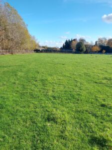
For example, the photograph below shows an agriculturally improved field with patches of soft rush (Juncus effusus) which is grazed by sheep. It would be recorded as the habitat type ‘modified grassland’ (g4) with the essential code ‘scattered rushes’ (14) and the additional secondary code ‘sheep grazed’ (102). Following the UKHab coding system, it can be abbreviated to g4 14 102.
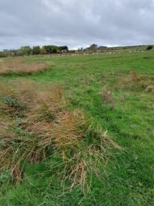
In each habitat parcel, a surveyor takes photographs and records the presence and abundance of plant species within quadrats. These botanical data underpin the surveyor’s choice of UKHab habitat type and secondary codes.
In addition to a UKHab survey, surveyors can also undertake Habitat Condition Assessments for each habitat feature.
What are Habitat Condition Assessments?
The UK Habitat Condition Assessment is a structured method for assessing the health and quality of habitat features using statutory condition sheets. The statutory condition sheets are based on UKHab and were designed to integrate with the statutory biodiversity metrics for Biodiversity Net Gain (BNG) as well as to inform conservation efforts.
Each habitat type has a condition sheet with specific criteria that need to be evaluated. The assessor either passes or fails each criterion for a specific habitat parcel to give a score of poor, moderate or good condition.
UKHab surveys and habitat condition assessments should be undertaken by a competent person with the necessary skills, and at the optimum time of year for the assessed habitats.
What are UKHab and Habitat Condition Assessments used for?
UKHab was designed to assist ecologists and other appropriate practitioners to identify, record and map habitats for a variety of purposes in a consistent and uniform way. UKHab and condition assessments are used for:
-
Preliminary Ecological Appraisals (PEA)
A UKHab survey is included in a Preliminary Ecological Appraisal with the option to also include habitat condition assessments.
-
Biodiversity Net Gain (BNG)
UKHab is the system upon which the Biodiversity Net Gain metric is based. Hence, all BNG projects require a UKHab Survey and condition assessments to establish the biodiversity ‘value’ of a site before and after development works.
-
Biodiversity conservation
UKHab and condition assessments can establish habitat baselines from which to inform nature-based decision-making, guide land management and monitor land use change.
EcoNorth’s Work using UKHab
EcoNorth’s ecologists are highly skilled and experienced in undertaking habitat surveys for clients in a wide variety of contexts including PEA, BNG and biodiversity conservation projects.
EcoNorth uses Coreo software to collect UKHab data in the field. Coreo supports UKHab and BNG which means we can map habitats to high levels of spatial accuracy and collect and process data in an efficient workflow.
This technology was particularly beneficial to our recent work delivering habitat surveys for two major landscape-scale nature recovery projects in Northumberland.
EcoNorth’s UKHab survey of Wild Kielder (6000 ha)
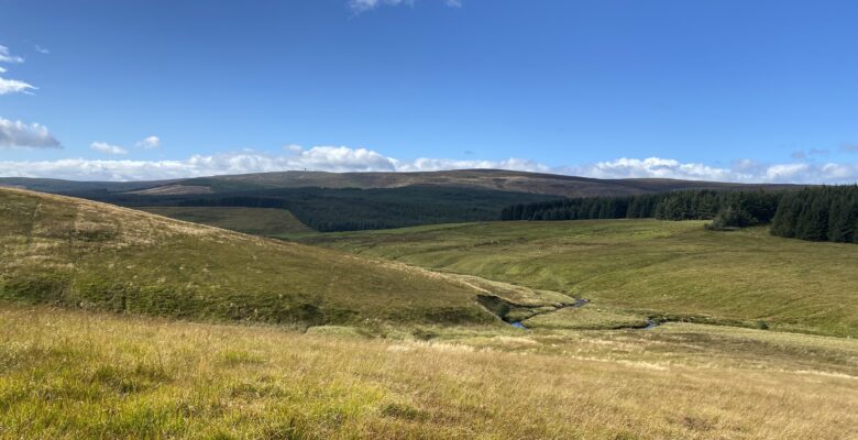
In 2024-25, EcoNorth delivered a full UKHab Survey of the entire Wild Kielder Project Area, in Northumberland, for Forestry England – a staggering 6000 ha site and probably the largest UKHab survey in England! This was a highly complex habitat survey of a vast and diverse upland landscape encompassing conifer plantations and a large part of the Kielderhead National Nature Reserve (NNR). The site included extensive areas of blanket bog, upland heathlands, wetlands, grasslands and woodlands.
To survey the huge site, a team of EcoNorth ecologists mapped all habitat parcels to a minimum mapping unit of 400 m2 and recorded quadrat data and habitat condition assessments. In total, a remarkable 3458 botanical quadrats were recorded!
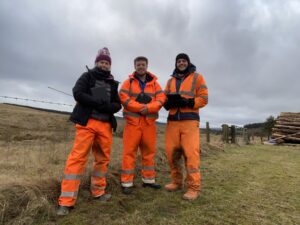
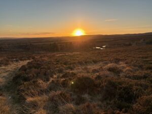
Not only was this a huge habitat survey, it was also a logistical challenge for EcoNorth’s botanical surveyors who navigated the remote upland terrain on foot for several months through the best and worst of the Northumberland weather! The surveyors worked independently to cover the vast terrain, following strict risk assessment procedures and communicating with each other onsite using radios. The team completed the project with an exemplary health and safety record and gained invaluable experience of conducting UKHab surveys at landscape scales in upland conditions.
A final report and the complete survey results were delivered to the client. Lead surveyor and Senior Ecologist, Dr Sarah Barlow, said “We are extremely proud to have delivered the Wild Kielder UKHab survey for Forestry England. The large botanical datasets are a hugely important baseline from which to inform future habitat management and monitoring of the Wild Kielder Project Area.”.
EcoNorth’s UKHab survey of the Rothbury Estate (2000 ha)
In 2025-26, EcoNorth undertook a similarly extensive UKHab survey of a 2000 ha area of the Rothbury Estate, in Northumberland, for the Royal Society of Wildlife Trusts (RSWT). Drawing on their experience of surveying Wild Kielder, EcoNorth’s expert team of habitat surveyors were ready and able to go!
The RSWT, working with the Northumberland Wildlife Trust, has plans to boost nature recovery on the former shooting estate previously owned by the Duke of Northumberland – positive news that has received attention in the media of late and the support of Sir David Attenborough no less.
The Rothbury Estate holds huge potential for habitat restoration and nature recovery at scale. It was, therefore, necessary to establish a habitats baseline to inform management and monitor the effects of land use change over time.
Planning a UKHab survey of this scale started with client consultation and a desk study to pull together relevant useful background information about the site. Ecologist Sam Graham said “We collated contextual information about the site to make a master map which helped us plan and carry out the survey on the ground. We also used the desk study to inform a risk assessment which we dynamically reassessed during fieldwork”.
During the UKHab survey, an array of habitats was recorded including farmland for grazing livestock and a diverse landscape of upland heathlands, deciduous woodlands and upland mires and blanket bog. In total, 1924 ha of habitat parcels and 30 km of linear features, such as hedgerows and lines of trees, were mapped and condition assessed and 2766 botanical quadrats were recorded.
Senior Ecologist, Dr Sarah Barlow, added “The site is a complex jigsaw of different upland habitats that have been modified by land use such as grazing, drainage and burning, which required real attention to detail to thoroughly map”.
Following completion of the UKHab survey and condition assessments, the maps and large botanical datasets were provided to the client with a final report.
Ecologist Jamie Birtwistle said “…surveying the habitats within the Rothbury Estate was a dream job. It wasn’t uncommon to spot signs of wildlife too, such as hare, raven and otter. Knowing that the habitat data we collect will be used to help nature recovery is a hugely rewarding part of my job with EcoNorth.”
For more information on our ecological services involving botanical surveys, please contact Dr Sarah Barlow at sarah.barlow@econorth.co.uk.